


Irleau

olaze
User

Length
8 km

Max alt
14 m

Uphill gradient
43 m
Km-Effort
8.6 km

Min alt
0 m

Downhill gradient
43 m
Boucle
Yes
Creation date :
2018-04-17 13:21:58.656
Updated on :
2018-04-17 13:21:58.656
2h00
Difficulty : Easy

FREE GPS app for hiking
 SityTrail
IGN / Geographical institutes
SityTrail Plus
The world is yours!
About
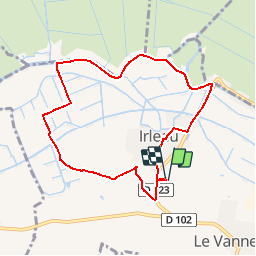
Trail Walking of 8 km to be discovered at New Aquitaine, Deux-Sèvres, Le Vanneau-Irleau. This trail is proposed by olaze.
Description
Départ stade .
Campagne, marais, bord de Sèvre et retour Irleau.
Positioning
Country:
France
Region :
New Aquitaine
Department/Province :
Deux-Sèvres
Municipality :
Le Vanneau-Irleau
Location:
Unknown
Start:(Dec)
Start:(UTM)
681126 ; 5130361 (30T) N.
Comments